


A new website is providing Seaford-area residents with information on proposed flood risk mapping revisions.
DNREC wants Seaford residents to see some proposed floodplain mapping changes in the Clear Brook watershed and offer their feedback.
DNREC’s Division of Watershed Stewardship Michael Powell says they can do that by visiting a new website they’ve created.
“This is the Department’s website to get information out about floodplain mapping improvements that we’ve made to that watershed," said Powell. "We embarked in this study when we became aware through contact with local residents that FEMA’s (Federal Emergency Management Agency) floodplain maps did not appear to be accurate in that area.”
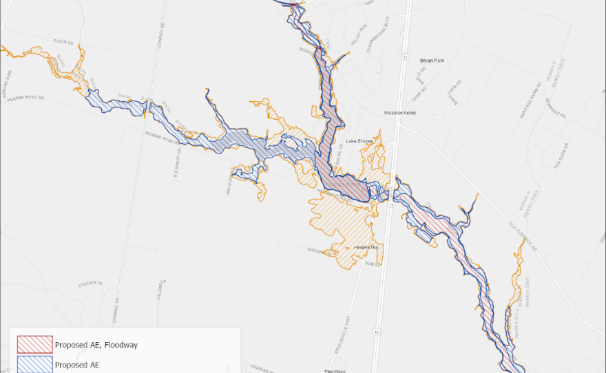
Powell says they studied the watershed, a five mile stretch of stream from Williams Pond, up Clear Brook through Hearns Pond, and hired an engineering contractor to update the maps.
Powell says the proposed Clear Brook changes are the result of a recent evaluation that found the Hearns Pond floodplain is receding and areas downstream were expanding slightly.
He notes fewer than 50 houses are affected by this floodplain.
He adds the website includes a https://www.youtube.com/watch?v=QKfODManYVI">video with information on how the proposed changes may impact properties and flood insurance rates.
Powell adds that DNREC works with the Federal Emergency Management Agency (FEMA) to improve the accuracy of flood risk maps statewide. Ultimately, FEMA will adopt these changes and produce updated federal floodplain maps for the watershed.
Seaford residents can submit comments on the proposed changes until May 31, 2020.


